The soil profile changes dramatically between the north and south ends of Sault Ste Marie. Near the St. Marys River, you encounter soft organic silts and saturated fine sands that offer little resistance. Move inland toward the bedrock-controlled terrain of the Canadian Shield and you hit dense glacial till within a few metres. This contrast means a foundation design that works near Great Northern Road may fail completely along Bay Street. The Standard Penetration Test provides the quantifiable data needed to navigate these transitions. By driving a split-spoon sampler 450 mm into the ground and counting blows per 150 mm increment, we obtain N-values that correlate directly with relative density in sands and consistency in the local varved clays deposited by glacial Lake Algonquin. For sites with deep clay deposits, we often pair SPT data with a CPT test to refine the stratigraphic profile without sample disturbance.
N60 values below 4 in the riverfront clay indicate a site class E profile that triples the spectral acceleration for structural design.
How we work
The Ontario Building Code references NBCC 2020 for seismic site classification, which relies heavily on SPT N60 values averaged over the upper 30 metres. In Sault Ste Marie, where the seismic hazard is moderate but the soil amplification potential on soft lakebed deposits is high, getting this number right matters. We use an automatic trip hammer system conforming to ASTM D1586-18 to ensure consistent 63.5 kg weight drop from 760 mm. The energy ratio is calibrated to 60% via instrumented rods, so the reported N60 is corrected for hammer efficiency. Disturbed samples retrieved from the split spoon undergo visual classification in our lab, and we cross-check plasticity characteristics with Atterberg limits testing when fines content exceeds 50%. Borehole depth typically ranges from 10 to 25 metres, depending on whether refusal is encountered on bedrock or the investigation targets a specific bearing stratum. Groundwater level is recorded 24 hours after drilling to account for the slow equilibration in the local silt aquitards common in the west end.
Local considerations
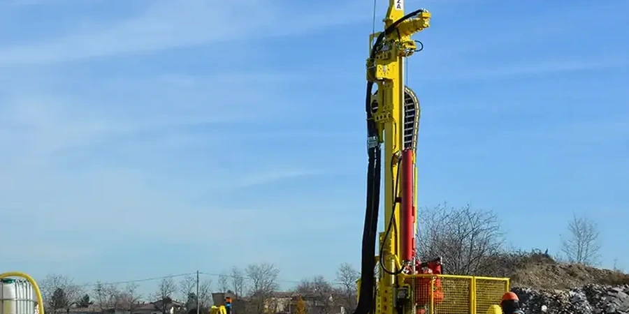
The CME-55 drill rig we mobilize to Sault Ste Marie sites weighs roughly 8,500 kg and requires stable working platforms on the clay-rich soils typical of the city's east side industrial parks. If the access pad is not built up with granular fill, the rig tracks can break through the desiccated crust into soft saturated clay below, delaying the program by days. Beyond logistics, the primary technical risk is misinterpretation of blow counts in coarse granular strata. The Precambrian bedrock surface is irregular across the city, and boulders embedded in the overlying till can produce refusal-like N-values that mimic bedrock. Differentiating between a large cobble and the true rockhead requires experience and correlation with the drill rig's hydraulic pressure readings. We log each run carefully, noting the presence of angular shield clasts versus weathered sandstone fragments.
Frequently asked questions
What is the typical cost of an SPT investigation in Sault Ste Marie?
Standard borehole programs with SPT sampling in the Sault Ste Marie area typically range from CA$800 to CA$990 per borehole, depending on depth, access conditions, and whether winter drilling surcharges apply. This includes mobilization, drilling, sampling at 1.5 m intervals, groundwater monitoring, and a factual report with N60 logs.
How many boreholes are required for a single-family home foundation design?
For a residential lot in Sault Ste Marie, the Ontario Building Code generally requires a minimum of one borehole if soil conditions are uniform. On larger properties or sites with known variability, such as those near filled ravines or the riverfront, two strategically placed boreholes provide the necessary coverage to satisfy Part 4 geotechnical requirements.
What is the difference between N-value and N60?
The raw N-value is the total blow count recorded in the field. N60 is corrected for hammer energy efficiency, rod length, borehole diameter, and sampler configuration to standardize the result to 60% of the theoretical free-fall energy. We use instrumented rods to measure the actual energy ratio delivered by our automatic hammer in Sault Ste Marie operations, and apply correction factors per Skempton (1986) recommendations.
Can SPT be performed in the winter months in Sault Ste Marie?
Yes, we conduct winter drilling programs routinely. Frozen ground is penetrated with hollow-stem augers fitted with carbide cutting teeth, and the casing is advanced through the frost zone before sampling begins. The SPT procedure itself is unaffected once the thawed soil is reached, though site access planning for snow clearing adds preparation time.
How do you handle groundwater observations in SPT boreholes?
We install a slotted PVC standpipe in the completed borehole and measure the stabilized water level after a minimum 24-hour period. In the fine-grained silts and varved clays common in Sault Ste Marie's west end, equilibration can take significantly longer, so we often take a second reading at 48 hours to confirm the static level before backfilling the hole with bentonite grout.