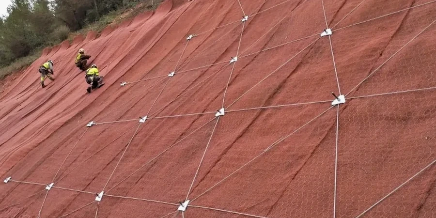
Around Sault Ste Marie, many cut slopes along the escarpment and river valleys start showing tension cracks much earlier than owners expect. It is rarely a single factor, but rather a combination of glacial till overlying fractured bedrock, seasonal freeze-thaw cycles that open joints wider every spring, and the occasional heavy rain event that saturates the overburden. When we walk a site for the first time, the question is not whether the slope will move, but how much deformation the planned structure can tolerate. The analysis we deliver integrates site-specific shear strength parameters with the groundwater regime, because ignoring perched water tables in the silty sand lenses common to the St. Marys River corridor is the most frequent cause of failure we see in local projects. For deeper cuts where we suspect progressive failure along relic shear planes, we often recommend pairing the slope evaluation with a standard penetration test borehole to recover undisturbed samples from the critical slip surface depth.
A slope that stands today in Sault Ste Marie has already been tested by nature, but the next construction season or a heavier-than-average snowmelt can trigger the very failure surface that was dormant for decades.
Local considerations
Sault Ste Marie sits at roughly 192 meters elevation along the St. Marys River, but the terrain rises sharply toward the Algoma Highlands, creating natural and engineered slopes that have been adjusting since the retreat of the Laurentide Ice Sheet. The city records an average of 320 cm of snowfall annually, and the rapid melt in March and April generates a temporary pore pressure spike that reduces effective stress in the upper 3 to 5 meters of soil. We have observed that slopes which performed adequately during dry autumn conditions can reach critical equilibrium during this window, especially where the downslope drainage has been blocked by ice lenses or construction debris. The seismic hazard is moderate compared to the West Coast, but the 2010 Val-des-Bois earthquake reminded engineers that intraplate seismicity in Eastern Canada is real, and its attenuation characteristics differ markedly from the active plate boundary models used in Vancouver. A pseudo-static analysis with a horizontal acceleration coefficient calibrated to the NBCC uniform hazard spectrum for Sault Ste Marie provides a prudent design basis for permanent slopes near occupied structures.
Reference standards
NBCC 2020 – National Building Code of Canada, Division B, Part 4, CSA A23.3-19 – Design of Concrete Structures (retaining elements), CAN/CSA-S6-19 – Canadian Highway Bridge Design Code (Section 6, foundations and earthworks), ASTM D1586 / D1586M-18 – Standard Test Method for SPT and Split-Barrel Sampling, ASTM D3080 / D3080M-11 – Direct Shear Test of Soils Under Consolidated Drained Conditions
Frequently asked questions
What is the typical cost range for a slope stability analysis in Sault Ste Marie?
For a single-family lot or a small commercial cut slope, the investigation and analysis usually range from CA$1,780 to CA$6,110, depending on whether we need to bring in a drill rig for samples or if hand-augered test pits and field shear vanes are sufficient. Larger infrastructure projects with inclinometer installations and multiple cross-sections exceed this range and are quoted case by case.
How long does a slope stability study take from start to finish?
A standard study including field investigation, laboratory testing of the recovered samples, and the analysis report takes between three and five weeks. If the scope requires groundwater monitoring over a seasonal cycle to capture the spring high-water condition, the overall timeline extends to six or eight months, but the preliminary analysis can be delivered much sooner to avoid delaying the project schedule.
Do you use the same analysis method for natural slopes and engineered cut slopes?
The principles are the same, but the approach differs. For natural slopes, we focus on identifying relic shear surfaces and the groundwater regime, often applying the Morgenstern-Price method because it handles non-circular slip surfaces well. For engineered cuts, we add kinematic analysis for structurally controlled wedge failures in the bedrock, which is a dominant mode in the jointed granite and gneiss of the Canadian Shield around Sault Ste Marie.
Is a slope stability analysis required for a building permit in Sault Ste Marie?
The Ontario Building Code references the NBCC and requires a geotechnical assessment when the slope inclination exceeds 1V:3H within a distance equal to the slope height from the proposed foundation. The City of Sault Ste Marie planning department typically requests the analysis during the site plan approval stage for any construction near the escarpment or the riverbank corridors.